Lie of the Land
The hidden watercourses of Preston
Topography
Topos is Greek for ‘Place’ and Graphy is Greek for ‘Description,
Writing or Recording’ – so Topography is a description in words and
/or drawings of a place. We tend to use it about the physical
features of a landscape in a specific location.
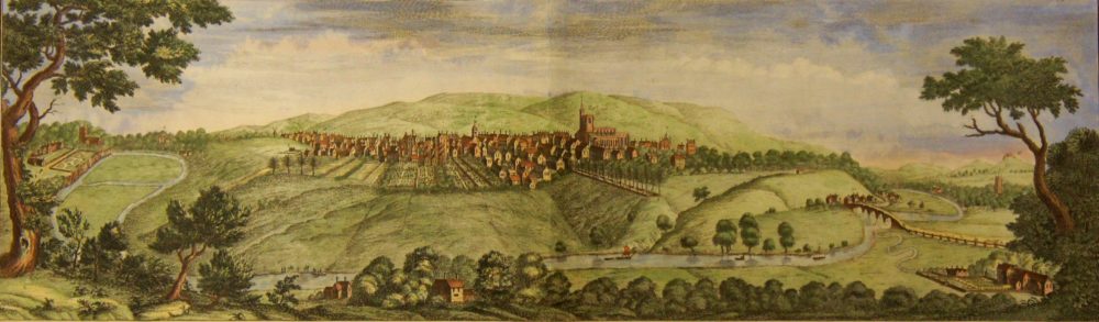
Preston is a city built on top of a ridge high above the River Ribble. But this ridge is no longer flat. Over time streams and small rivers have carved valleys into the landscape. These water courses have been culverted and are now hidden from view but they are still there, flowing underground.
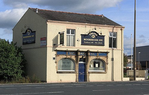
The Moorbrook Inn on North Road is named after the Moor Brook which runs west to the Ribble. When you walk downhill from Moor Park to the Moorbrook Inn and then walk uphill to Church Street/Fishergate you are walking on slopes which are the sides of a valley formed by the Moor Brook.
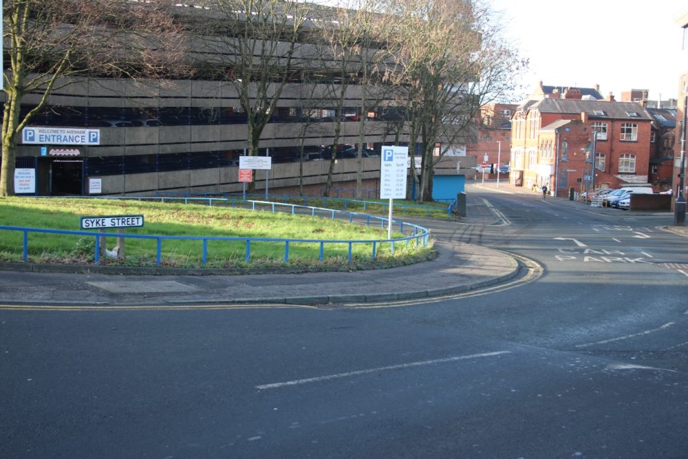
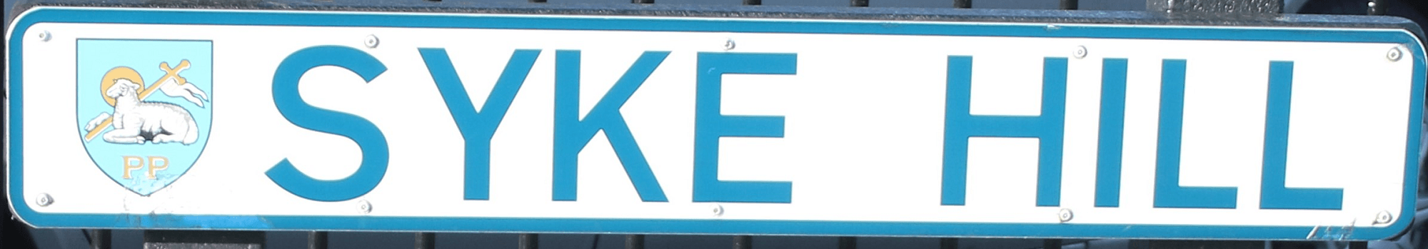
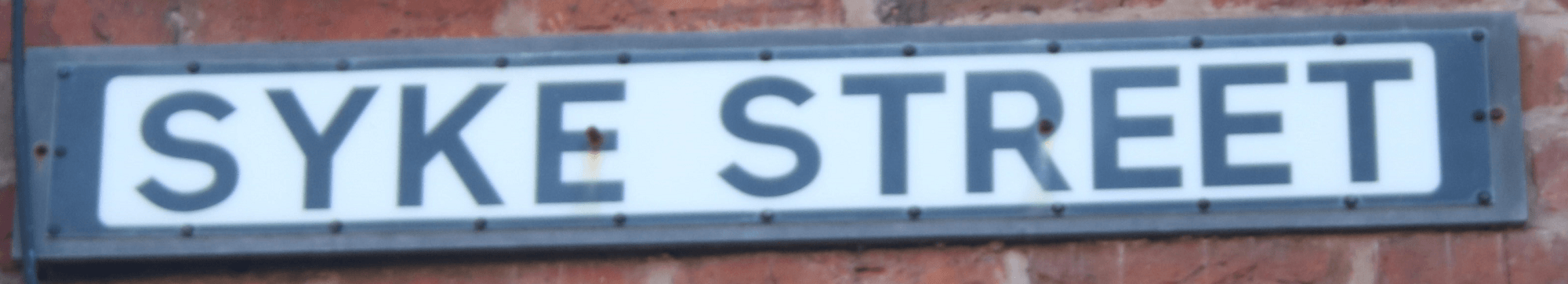
Another significant stream/small river in the town was the Syke; sometimes known as the Avenham Syke. It rises from a spring at the junction of Grimshaw Street and Queen Street at a height of about 40m above sea level and then flows west to the Ribble; down and along Syke Hill and Syke Street, Cross Street, Winckley Square, Garden Street and then under the railway towards Broadgate and the Ribble.
Selecting a site
When William Cross looked for a site to establish a fine square in Preston he would have used a number of criteria.
- It needed to be on undeveloped land.
- It should be to the west of the factories which were being built. The prevailing winds blow from the west so the air over the square would be cleaner if it didn’t pass through and carry smoke from chimneys.
- It would need to be near the existing large houses and key cultural and business centres; which meant neither far from Fishergate nor from Avenham Walk.
Town End Field and land around it offered the size of plot needed and proximity to the existing homes of the gentry. Just as importantly it was available for sale and it was on the western fringe of what was then the extent of the town.
We don’t know whether William Cross saw the undulations of the site as a problem or an asset but he went ahead.
Improving the site
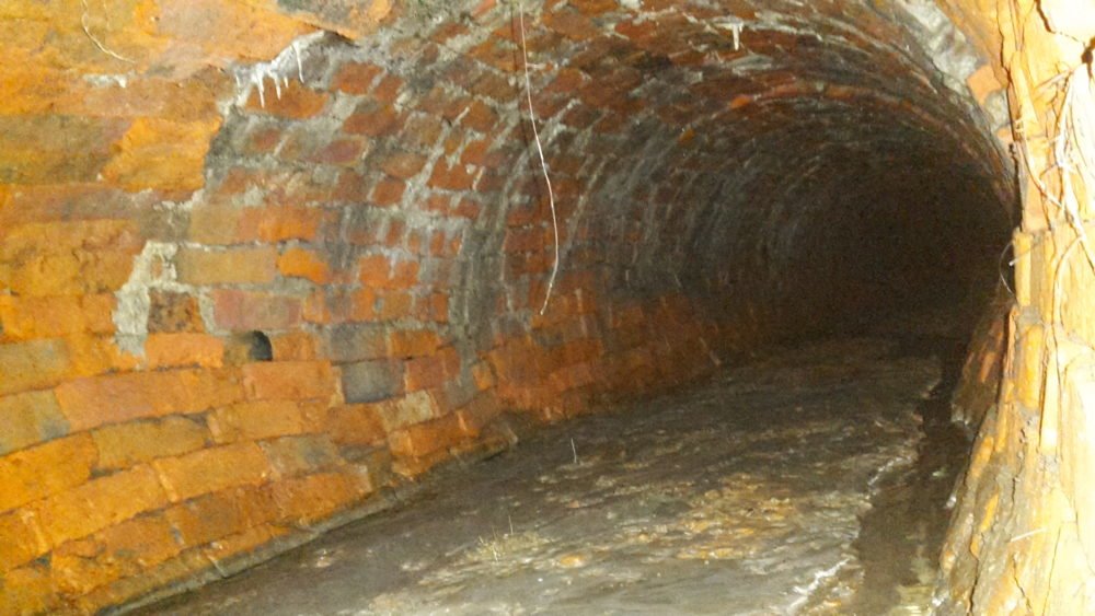
The culverting of the Syke in 1812 and the purchase of the land south of the Syke were critical points in the development of the Square. When the first houses were built (from 1799) the Syke was an open water course.

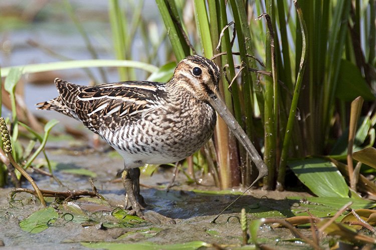
Snipe
The Syke had snipe (a wading game bird) nesting and feeding in its boggy banks. It presented a barrier to anyone on foot. The culvert solved that problem. The Syke was increasingly being used as an open sewer, not a good feature for a new high status square; the culvert hid that too.
Syke (or Sike) is Middle English and Norse for a small river or stream. It is very common in the Trough of Bowland and in much of Lancashire, Yorkshire and Cumbria. Stock Beck in Pendle, which feeds into the Ribble, has no fewer than eight sykes flowing into it along with five becks, two gills and two dikes!
Preston had a number of sykes. Suckling Syke and Spittal Syke are just two such. The one through Winckley Square was often referred to as Avenham Syke but latterly became known simply as ‘The Syke’.
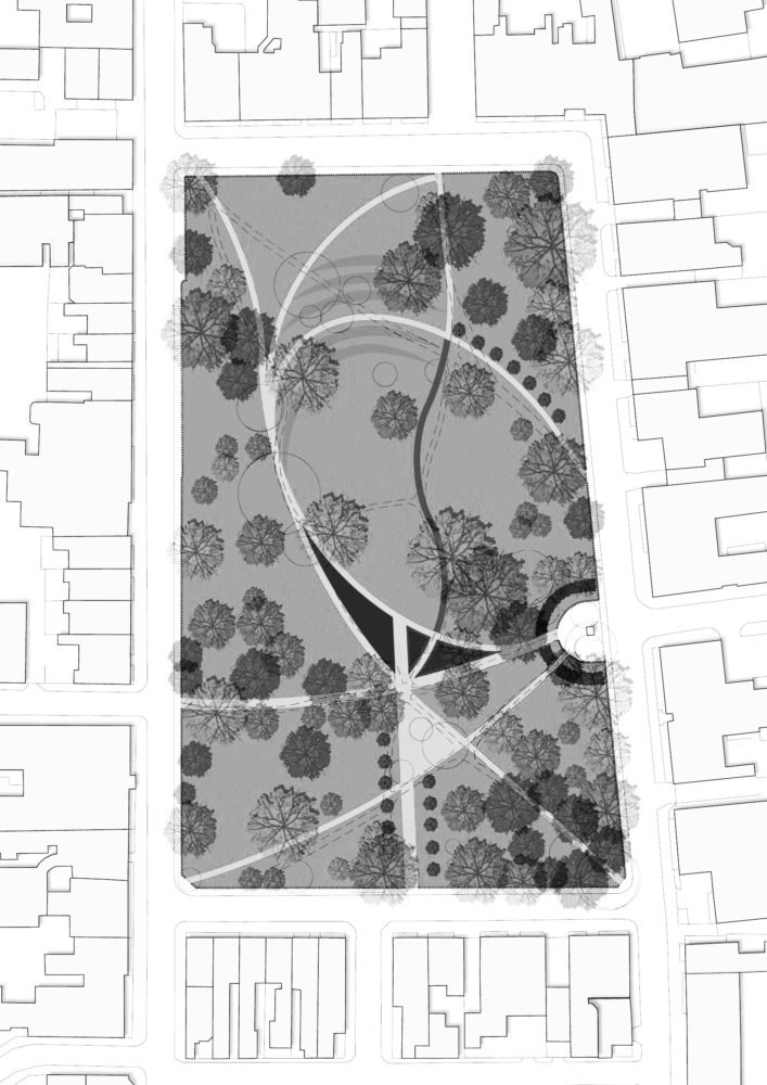
Is Winckley Square actually square?
No, it certainly isn’t. It’s not even an oblong. It has four sides but the south side is about 20 metres longer than the north side. It doesn’t have right angled corners. So it’s a Quadrilateral. More specifically, it’s a Trapezium, as the north and south sides are parallel.
We doubt Thomas Miller would have been keen for the address of his mansion to be 5, Winckley Trapezium!
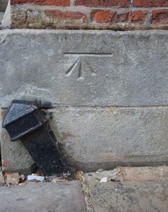
Benchmarks
The height of land on maps is given as a figure above sea level. (The sea level is based on the level measured at Newlyn in Cornwall). There are various locations close to the Square where you can see, marked in stone, the location of the benchmark where surveyors in the past measured the height.
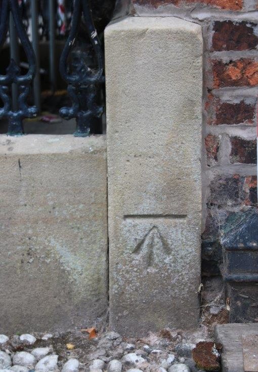
The two benchmarks (BM) shown here are at opposite ends of Winckley Square. The BM at 5, Winckley Square (on the corner with Winckley Street) is 32.1015m above sea level. The BM at 15, Winckley Square (on the corner with Camden Place) is 27.7642m above sea level
So we can see from these two readings that the northern side of the Square is almost 5 metres higher than the southern side
You can check all the heights around Winckley Square on the Bench Marks Database
By comparing the position of BM letters on an old map, such as the 1892 1:500 OS map, you can check on the database which remain and which have gone.
On older OS maps, benchmarks appear as BM with a number next to them given in feet. Modern maps use a dot with a figure given to the nearest metre. Benchmarks on buildings are steadily disappearing. Road widening and redevelopment result in their destruction. They are not replaced.
They are called benchmarks because at one time an angle iron was slotted into the chiselled horizontal line. A levelling rod was then balanced on it to check the height. The angle iron acted as a stable ‘bench’. These two examples have chiselled arrows pointing to the line.
Is Winckley Square unique?
We aren’t sure but all the other Georgian squares we have visited, including many in London and Dublin, are flat. Most Georgian squares in the British Isles were laid out on land that was naturally flat or land that was engineered to create a flat space.
To some degree this provided the horizontal ‘order’ to match the ‘order’ of the buildings around the squares. These followed strict geometric principles. Georgian architecture was influenced greatly by the classical styles based on Ancient Greece and Rome. The Greek ‘Agora’ and the Roman ‘Forum’ were flat open spaces.
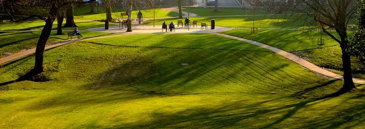
In contrast, while the buildings around Winckley Square largely followed the fashion of symmetry and order, the enclosed plot of land itself reflects the ‘lie’ of the land, relatively undisturbed. The roads and pathways outside the perimeter were smoothed out but, inside the railings, the undulations of the land give Winckley Square a real feel of being the countryside in the city -‘Rus in Urbe’.
Towards the end of the eighteenth century many new flat squares were laid out to give a ‘country in the city’ feel. They were planted in a naturalistic, informal manner with shrubberies surrounded by a gravel walk and railings.
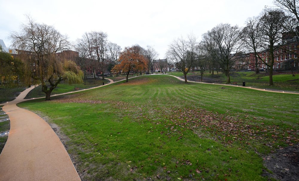
Winckley Square has the additional benefit of undulations, greatly enhancing the sense of ‘Rus in Urbe’.
By Steve Harrison